

Anchorage, Talkeetna, and our Cabin in Denali
We awoke at 5:30am (which happily felt like sleeping in), and checked out of the hotel. We got us some Starbucks downtown, then stopped at a supermarket for the supplies we felt might be hard to come by in Denali. They were playing Don’t Stop Believin’ over the loudspeaker, just for me. I also stocked up on decongestants, because I’d stopped being able to breathe since we’d gotten to Alaska.
We were well up the Parks highway by 8:30am, passing through the few suburbs of Anchorage, and then out into what felt like the middle of nowhere. It looked kind of like northern Wisconsin for a while; pine trees, cabins, and the occasional tavern. We stopped at Montana Creek to look around and climb under the railroad trestle, then headed to Talkeetna, a little town about 15 miles off the highway. It’s reportedly the model for the town in the show “Northern Exposure”.


talkeetna mermoose
Talkeetna is ridiculously cute. It’s all outfitters, gift shops, a famous old general store, and restaurants. Everyone is friendly. We wandered around a bunch of artsy little shops, stopped to talk to Stubbs the cat, the mayor and mascot of Talkeetna (as one of the locals informed us), and walked up to see the depot where the Alaska Railroad pulls up along the Susitna River.

this tiny airport is where almost all Mount McKinley/Denali climbing expeditions begin.

stubbs!
We had lunch out on the patio at the West Rib Pub, then wandered around the town some more.

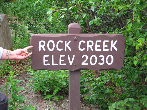
We went back out to the Parks highway and continued towards Denali. We stopped at a few overlooks in Denali State Park, where we encountered our first bear warning signs, and got our first (very limited) view of Denali.


in denali state park

my obligatory sideview photo
We reached Denali National Park around 6:30pm, and drove up to our hotel, located in the little community across the highway from the park entrance, which doesn’t even have a name; directions are given based on the mile marker on the Parks Highway.
The Denalis Crow’s Nest was spectacular. It’s a bunch of cute little cabins lining the side of Sugarloaf Mountain. Ours was on the fourth tier at the far end, with a great view of Mount Healy and the park entrance. It was set up like a rustic hotel room inside, and had a couple of chairs and little table out front on the deck. We couldn’t have picked a better place to stay.

the denali party cabin (ours is the last on the left)

We unpacked and went downstairs to the Overlook Bar and Grill for dinner. We sat on the patio drinking girly drinks from milk bottles and staring at the park. It was kind of hard to believe we were actually there. After dinner, we went up and sat on the patio, reading. We had trouble deciding when to go to bed, because the sunset never actually happened.


 I was cranky as hell, as I usually am in the morning. It seemed to take an extra long time to get there, which we finally did around 11:30. Heather wanted to do some present shopping at the Old City Market (on eBay Street!), I wanted to pee. We drove around and around looking for parking, but the place was mobbed. Finally, I told her to go shop and I’d keep looking for parking, and call her when I found it. I never did. Around 12:30, about to pee my pants, I called her and told her we had to switch so I could go to the bathroom, so we did that. Then she went back in for more, and I circled until she was ready to go. Charleston is an incredibly beautiful city, but when you don’t have time to enjoy it, what’s the point?

 We went into the Sanders Cafe, which is a functioning KFC attached to the original restaurant. There are some statues and displays honoring the (fake) colonel, which were reminiscent of the


 Whereas eastern Montana was all hills and scenic vistas, central Montana is rolling grasslands as far as you can see. (Do you remember that scene in

 In Montana, those crosses are an organized effort. Everywhere someone has died on the road, they put up a little white cross. Often, you see clusters of crosses. I saw way more dead people than living people on Highway 2.


 By the time I got near the top, my shoes were soaked, and there was snow creeping down my ankles and into my socks. The ground was muddy, and we had to pick our way through streams by balancing on rocks. At the overlook, there was a crown of people lounging in the sun, eating protein bars and drinking gatorade. We took each other’s pictures and enjoyed the view. I tried hard not to think about how I was more likely to make it down the mountain inside a giant snowball than on my own feet.
 Now, I’m the first to admit that I’m completely unprepared for any sort of wilderness adventure, because I find myself asking questions like, ‘Can mountain goats hurt me? Should I be standing this close?’ (I’m the same girl who’s impressed with the preparedness of the other snow-climbers just because they’re wearing hiking boots and carrying walking sticks.)
 Very slowly, we crept along the trail, teetering on the far edge whenever people had to pass going the other direction. A few times, I started to panic and had to just stop and stand there, up to my calves in snow. But I made it through, and ran the rest of the way down the hill. By the time I got to my car, my feet were numb from the cold, and I was starving.
 Outside Oakland, it’s all rolling hills, dry grass, and wind farms. I loved all the windmills lined up along the tops of the hills. They were cool and menacing at the same time. The farther I got from the bay, the warmer it got. It had been 50 degrees and misty in SF. By the time I exited 520 in Manteca, it was in the mid-80s.
 I got to Yosemite around 11am, and congratulated myself on the fact that my National Parks pass had already paid for itself. I drove up to about 6000 feet, then down into the valley. I stopped and hiked to Bridalveil Falls. The spray was a relief from the heat. There were lots of people there, wading around in the stream, trying to keep cool. The heat made visiting the pit-toilet restrooms an endurance test: how long can I hold my breath while peeing? How fast can I run away and find someplace to wash my hands? I noticed that all the tourists there were slow-moving, although maybe it was the heat. I felt bad barging my way through them to experience America’s natural wonders, but I had a schedule to keep.

 I hit I-70 and was excited by the sign reading ‘Richfield’; I wanted that to mean Richfield, Minnesota, where I live. I stopped a few times to go to the bathroom. Then I stopped in Richfield to try and find coffee, but couldn’t. I was zoning out again, eating sunflower seeds to stay awake, and taking off my sunglasses so the glare would keep me alert. When I saw a sign telling me there was going to be a big stretch of nothing for 110 miles, I took that as my cue to stop.
